
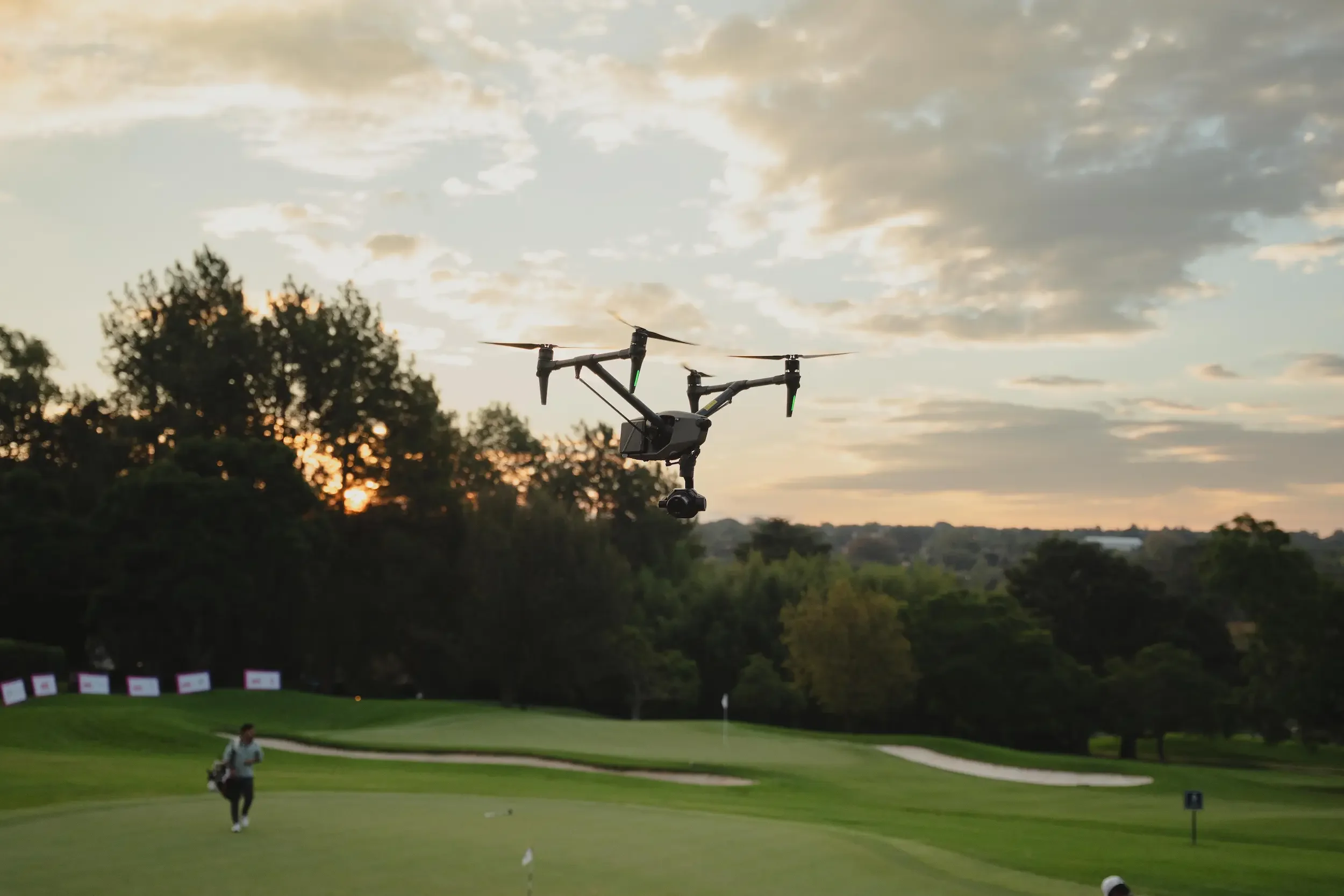
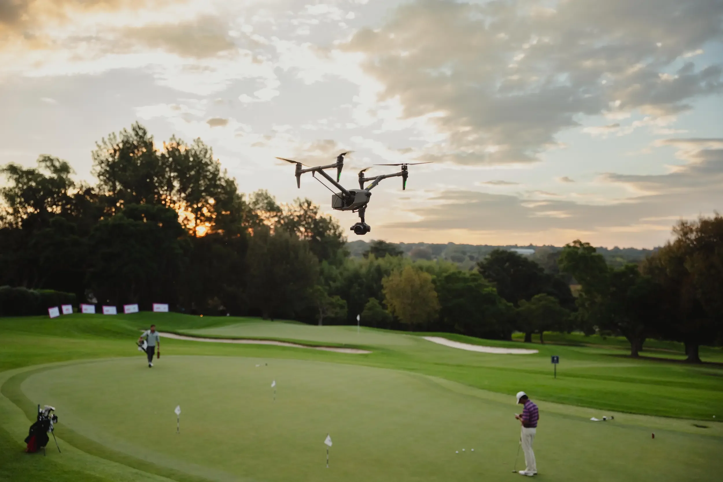
Drone Filming the IGPL at Royal Johannesburg Golf Club
Filming the IGPL (Indian Golf Premier League) at Royal Johannesburg with the DJI Inspire 3
We recently spent a full week at Royal Johannesburg Golf Club handling drone filming for the IGPL (Indian Golf Premier League).
This was one of those projects where everything had to come together properly. Not just from a filming point of view, but from a permissions and planning side as well. Between the live event environment and controlled airspace, there was no room for shortcuts.
The focus for the week was simple. Capture clean, usable aerial footage that fits straight into a professional broadcast.
What is the IGPL
The IGPL brings a slightly different feel compared to traditional golf coverage.
It is built more around teams and broadcast storytelling, rather than just individual play. That changes how you approach filming. You are not just getting wide shots of the course. You are thinking about how each shot fits into the production.
Timing matters. Movement needs to be controlled. Everything has to work with what is happening on the ground.
Royal Johannesburg Golf Club
Royal Johannesburg is one of the most established golf clubs in South Africa, with a history going back to 1890.
The East Course is the main championship course and has hosted events like the Joburg Open. It is known for being both challenging to play and visually clean, which makes it ideal for aerial work.
From the air, the layout works well. Defined fairways, well-placed bunkers, and enough elevation to create depth without needing aggressive flying.
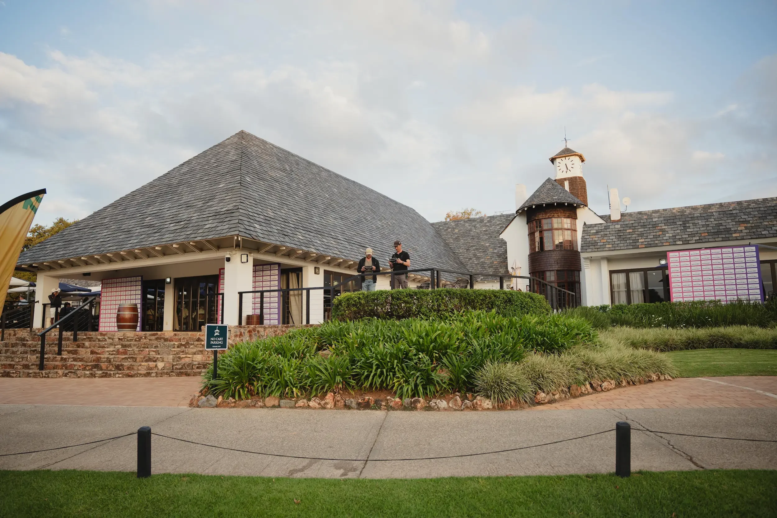
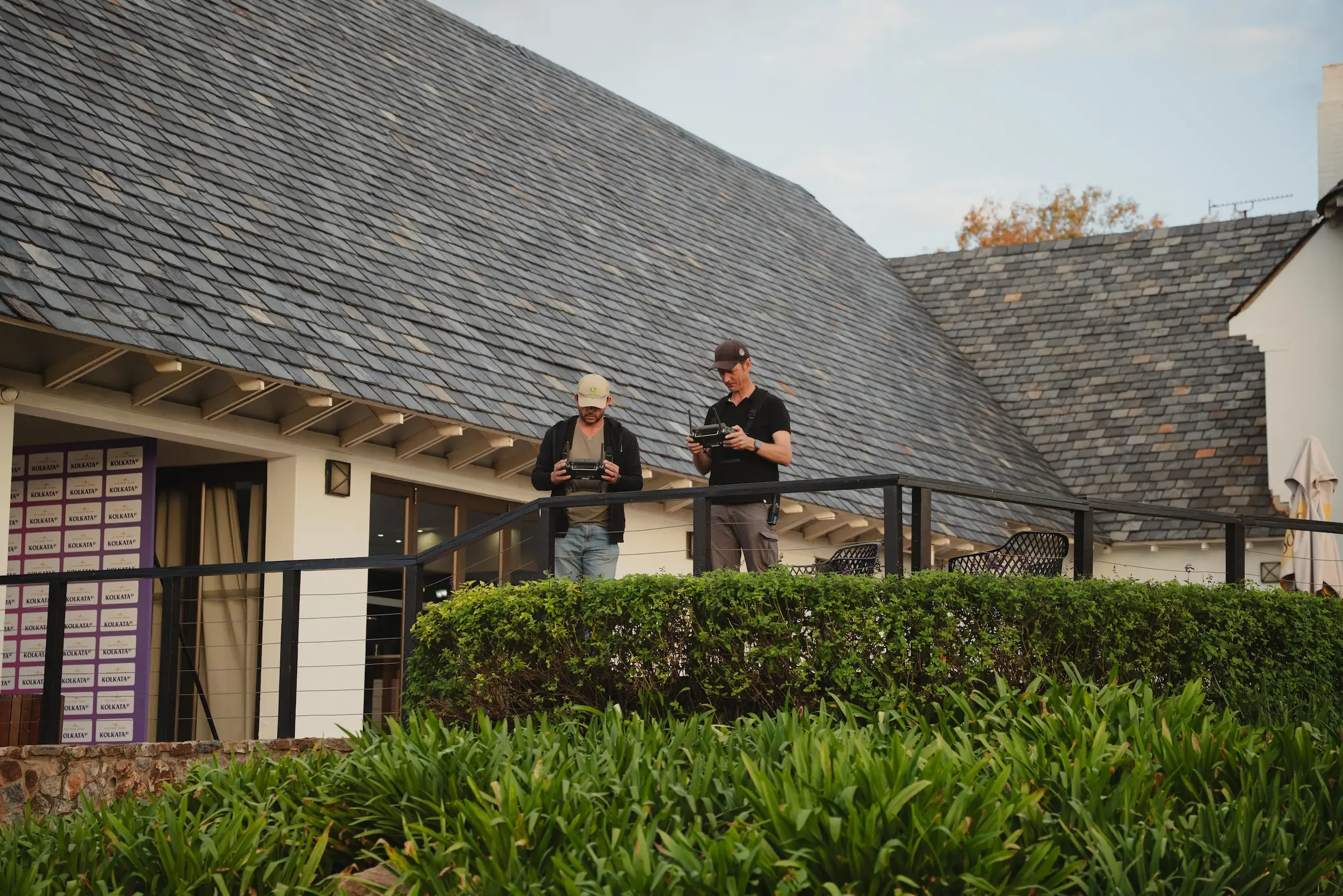
Behind the Scenes Drone Operations
A shoot like this is never just about flying.
Before anything starts, there is planning around take-off positions, safety zones, and coordination with the production team. During the event, you are constantly adjusting based on player movement, lighting, and what is needed next.
We worked from elevated positions where possible. That helps with line of sight, signal strength, and overall control.
Every movement is deliberate. You are not just flying for the sake of it.
Flying in Controlled Airspace
One of the biggest factors on this project was the location.
Royal Johannesburg falls within controlled airspace linked to OR Tambo International Airport. On top of that, the IGPL is classified as a public event.
That means two separate layers of approval had to be in place before flying:
Public event permissions
Airspace coordination with ATC
These approvals take time. They require planning, documentation, and proper communication with the relevant authorities.
This is not something that can be sorted out on short notice.
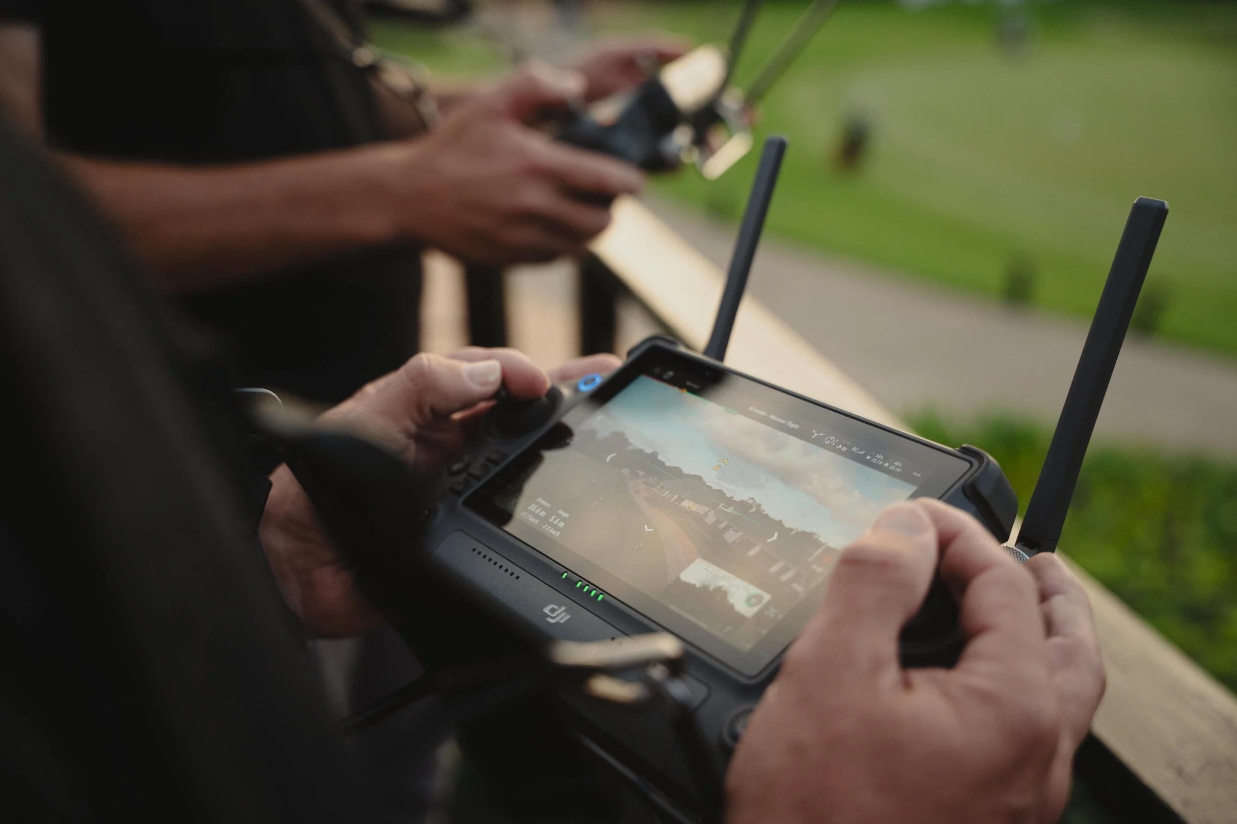
Equipment: DJI Inspire 3 Dual Operator Setup
For this production, we used the DJI Inspire 3 in a dual operator setup.
One person focuses purely on flying the aircraft. The second operator handles the camera.
This setup gives you much more control, especially in a live environment. The pilot can maintain a stable flight path while the camera operator focuses on framing and tracking.
It makes a big difference in the final result.
On-Site Workflow and Challenges
Even with planning, there are always variables.
Wind conditions shift. Light changes quickly, especially late afternoon. Player movement is not always predictable. You have to adapt without compromising safety or shot quality.
Golden hour flights stood out during the week. The softer light and longer shadows added depth and gave the footage a more cinematic feel.
Working in a live environment means constant awareness. You are always thinking ahead and keeping your flight path controlled.
Why Working with a Licensed Drone Operator Matters
This project is a good example of why proper licensing and compliance matter.
Between controlled airspace, public event regulations, and insurance requirements, there is a lot happening behind the scenes.
It is not just about flying a drone. It is about doing it legally, safely, and without disrupting the production.
That is what allows a project like this to run smoothly from start to finish.
Final Thoughts
This was a solid project to be part of. A well-run event, a great location, and the right setup to get the job done properly.
If you are planning a sports event, corporate shoot, or any project that requires aerial cinematography, it helps to have everything in place from the start.
If you would like to discuss an upcoming project, feel free to get in touch.

The Future Is in the Skies: Why You Should Start Drone Training Today
Drones aren’t just gadgets anymore — they’re shaping the way we work, create, and explore. From breathtaking aerial footage in films to property inspections, agriculture, and even live event coverage, drones are changing the game in South Africa.
The question is: are you ready to fly?
Whether you’re a new drone owner or looking to sharpen your skills, the right training can make all the difference. Flying a drone is more than just pushing a joystick — it’s about skill, safety, and knowing the law.
Why Drone Training Is a Must
Let’s face it: too many people buy drones and take off without a clue about what they’re doing. That’s risky. Without proper training, you could:
Accidentally break SACAA drone laws (and face fines)
Crash your drone and lose thousands of rands
Put people and property in danger
Miss out on capturing the amazing shots drones are built for
The truth is, good flying isn’t guesswork — it’s a skill. And like any skill, it can be taught.
Skill Building vs. Licensing: Know the Difference
Here’s the deal: our courses are not licensing programs. You won’t walk away with an RPAS certificate to fly commercially.
What you will walk away with is something just as valuable if you’re starting out:
Real flight experience in safe, legal airspace
A clear understanding of basic drone laws in South Africa
The confidence to handle your drone the right way
Practical skills that give you a serious head start if you ever go for your licence
Think of it as the foundation that sets you apart from the average weekend flyer.
Training That Fits Your Goals
At Aerial Drone Solutions, we keep our training practical and hands-on. Every course covers basic South African drone law so you know exactly where and how you can fly legally.
🚀 Beginner Workshop – 1 day of simple, safe, and fun flying. Learn pre-flight checks, flight modes, aerial photography basics, and the key SACAA rules you must follow.
🎯 Intermediate Training – 2 days of advanced flying, camera mastery, route planning, and deeper insight into drone laws and airspace awareness.
👤 Private 1-on-1 Sessions – A 3-hour personalised lesson built around your goals. Includes practical flying, gear assistance, and a refresher on the drone laws that apply to your flying environment.
No drone yet? No problem — we offer rental options so you can start right away.
⚠️ Note: This is not a licensing course. It’s a skill-building program designed to help you fly safely and confidently — and prepare you for the next step if you choose to go for your licence.
Learn From a Pro Who’s Been There
I’m Isak Burger, a licensed drone pilot with over a decade of experience flying for names like Netflix, SuperSport, Coca-Cola, and Standard Bank. I’ve seen how drones are transforming industries, and now I’m sharing that knowledge so you can fly with skill and confidence.
Drones Are the Future — Don’t Get Left Behind
Drone technology in South Africa is growing fast. From business opportunities to personal passion projects, the sky really is the limit. Starting your training now puts you ahead of the curve — ready for whatever the future brings.
Frequently asked questions
-
Not for recreational flying — as long as you follow SACAA’s basic drone laws. To fly commercially, you’ll need an RPAS licence. Our training isn’t a licensing program, but it covers the essential laws and safe practices every pilot should know.
-
We offer three options:
Beginner Workshop – 1 day of practical basics and drone law.
Intermediate Training – 2 days covering advanced flying, aerial photography, and deeper airspace awareness.
Private 1-on-1 Sessions – 3 hours customised to your goals, with a refresher on the drone laws that apply to your flying environment.
-
Our training takes place in Pretoria East in safe, legal open airspace. Private sessions across Gauteng can be arranged on request.
-
Yes — we offer drone rentals for R500/day. Rentals include a fully charged drone, memory card, and a quick guide to safe handling.
-
While this is not a licensing course, the skills you’ll gain provide an excellent foundation for the practical part of the RPAS licensing process if you choose to pursue it later.
Ready to Take Off?
Our classes are small, personal, and designed to give you the confidence to fly safely from day one.
📞 Call or WhatsApp: +27 72 049 6035
📧 Email: info@aerialdronesolutions.co.za
🌐 Visit: www.aerialdronesolutions.co.za
⚠️ Note: This is not a licensing course. It’s a skill-building program designed to help you fly safely and confidently — and prepare you for the next step if you choose to go for your licence.

Licensed to Fly: Aerial Drone Solutions at Koeberg Nuclear Power Station
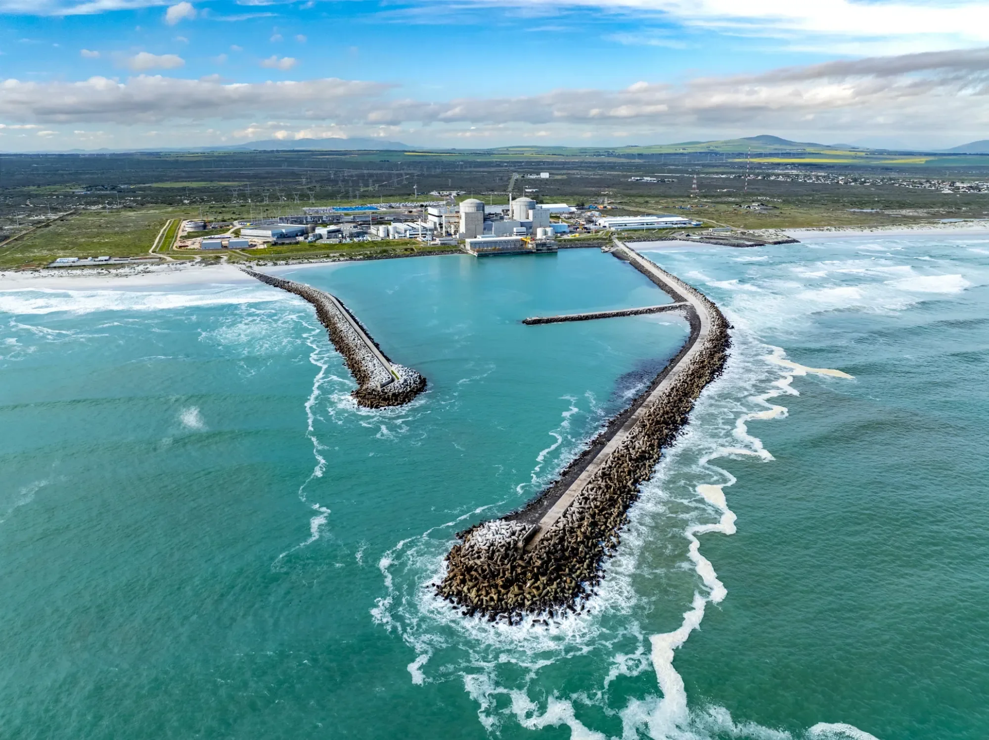
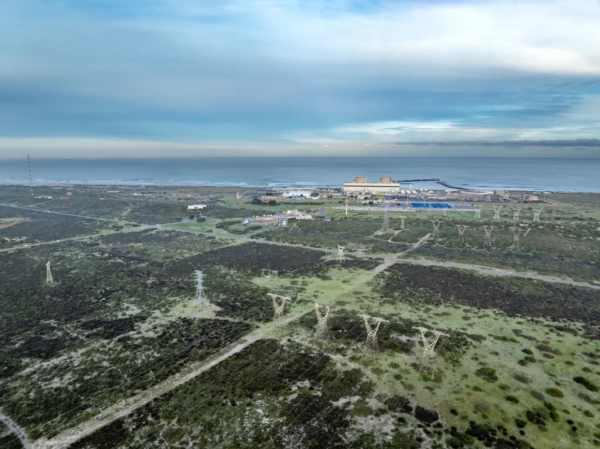
There are drone jobs, and then there are once-in-a-lifetime opportunities. Recently, I had the privilege of flying at Koeberg Nuclear Power Station, just outside Cape Town. For anyone who knows drones and South African aviation regulations, you’ll understand just how significant this was.
Koeberg is South Africa’s only nuclear power station. It’s not just another industrial site, it’s a national key point and sits inside highly restricted airspace (FAR36). That means you cannot simply show up with a drone and start flying. Permission, planning, and strict compliance with aviation and security protocols are non-negotiable. Being granted access to fly here was a huge milestone for me and for Aerial Drone Solutions.
Why Koeberg Is So Unique
Most people know Koeberg as the power plant that keeps the lights on in Cape Town, but the site is far more impressive when you look closer.
It generates around 5% of South Africa’s electricity. This makes it one of the single most important energy facilities in the country.
It is the only commercial nuclear power station on the African continent. That alone makes it stand out globally.
It is designed with world-class safety features, including the seismic float, an underground structure created to protect the reactors and critical equipment from earthquakes.
It sits in controlled and highly sensitive airspace, which means every aircraft, manned or unmanned, is subject to strict rules.
And here’s the part I am most proud of: I became the first drone pilot ever to fly inside the underground seismic float. That is not just rare, it is history in the making.
The DJI Mavic 3 at Koeberg
For this project, I used the DJI Mavic 3. Many people ask why I chose this drone instead of a larger platform like the Inspire or Matrice. The answer is simple:
The Mavic 3 is compact and highly stable, which made it perfect for operating in tight and sensitive environments like the seismic float.
Its Hasselblad camera system delivers professional-grade images and video, ensuring every shot met the strict requirements of the project.
The flight time and safety features gave me confidence when working in an environment where precision and reliability were non-negotiable.
Even though I regularly operate larger drones like the DJI Inspire 3 and Matrice series, this project showed the Mavic 3’s value in specialized industrial work.
The Process Behind Flying in Restricted Airspace
Flying at Koeberg was not as simple as unpacking a drone and taking off. Here is a glimpse into what it took to make this flight possible:
Approvals and permissions: Multiple layers of clearance were required, from Koeberg itself, Eskom security, and aviation authorities.
Compliance with SACAA regulations: Every flight had to follow strict guidelines set by the South African Civil Aviation Authority.
Risk assessments: Detailed flight planning, safety protocols, and emergency procedures were developed and approved.
On-site coordination: I worked closely with Koeberg staff to ensure every movement was aligned with their safety and security requirements.
This kind of preparation is exactly why unlicensed pilots cannot operate in places like Koeberg. The paperwork, security protocols, and trust required go far beyond hobby flying.
The Importance of Flying Legally
Flying at sites like this is not only about skill, it is about being properly licensed, certified, and trusted. When you are operating in restricted airspace, close to critical infrastructure, every step has to be by the book. That means working under SACAA regulations, carrying the correct approvals, and demonstrating professionalism at all times.
Unlicensed pilots could never access a site like Koeberg, and for good reason. The risks are too high, and the consequences too serious. If something were to go wrong with an unlicensed pilot, the legal and safety implications would be devastating.
This kind of work highlights why hiring a licensed drone operator is not just a box to tick, it is the difference between flying legally and safely, or not flying at all.
Why This Project Matters for Aerial Drone Solutions
Being one of only a handful of drone pilots to ever fly at Koeberg, and the only one to do so in the seismic float, is a major achievement. It shows the level of trust, professionalism, and technical expertise that Aerial Drone Solutions brings to every project.
For me, this was not just another job. It was proof of what is possible when skill, experience, and the right certifications come together. It also demonstrated how drone technology is continuing to find its place in industries that were once thought impossible to access.
How Drone Technology Supports Critical Infrastructure
Koeberg is not the only site that benefits from professional drone operations. Across South Africa and the world, drones are increasingly used to:
Inspect power plants and energy infrastructure without shutting down operations.
Survey and map construction projects faster and more safely than traditional methods.
Monitor hard-to-reach areas where manned inspection would be costly, dangerous, or impossible.
Capture visual records that support maintenance, safety, and compliance.
By combining expertise, the right equipment, and legal compliance, drones are becoming an essential tool in the management of sensitive infrastructure.
Final Thoughts
Flying the DJI Mavic 3 at Koeberg Nuclear Power Station was one of the proudest moments of my career. It showed not only the trust placed in Aerial Drone Solutions, but also how far the drone industry in South Africa has come.
From energy to construction to live events, the opportunities for drones are endless—but they come with responsibilities. At national key points like Koeberg, those responsibilities are magnified. This project proved that with the right training, licensing, and approach, drones can safely operate even in the most sensitive environments.
FAQ
Q: Why is flying at Koeberg such a big deal?
A: It is South Africa’s only nuclear power station, designated as a national key point, and located within highly restricted (FAR36) airspace—requiring rigorous security and operational clearances.
Q: What makes the seismic float special?
A: The seismic float is a unique underground structure built to protect the reactor and critical equipment from earthquakes. Flying inside it had never been done by drone—until now.
Q: Why is having a license so important?
A: Sites like Koeberg demand compliance with strict regulations (e.g., SACAA approvals), professionalism, and trust. Without proper licensing and certification, access—and safety—is simply not possible.
Q: What drone was used for this project?
A: The DJI Mavic 3, chosen for its stability, image quality, compact design, and reliability in a controlled environment.
Q: What value does this project bring to Aerial Drone Solutions?
A: It showcases the company’s trustworthiness, expertise, and ability to handle sensitive, high-stakes operations. It sets Aerial Drone Solutions apart in the South African drone industry.
Ready to Work With a Licensed Drone Pilot?
If you need professional drone services for commercial, industrial, or corporate projects, work with a team that has proven experience in restricted airspace and high-security environments.
📧 Email: info@aerialdronesolutions.co.za
📞 Phone: +27 72 049 6035
🌐 Website: www.aerialdronesolutions.co.za
Let’s discuss how we can bring the same level of professionalism and precision to your project.

Capturing Sandton City After Sunset with Virtual Planit

Sandton City completely transforms once the sun starts to dip.
Glass towers reflect the last bit of daylight, the lights flicker on, and the whole area turns from business hub to urban landmark. That’s exactly the moment we set out to capture.
I recently partnered with Virtual Planit to shoot aerial photos of Sandton City just after sunset. The goal was simple: capture the atmosphere and structure of this iconic part of Johannesburg, and support Virtual Planit’s work in architectural visualisation.
Who Is Virtual Planit?
Virtual Planit is a visualisation studio that works closely with architects, planners, and developers. Their focus is on the built environment — everything from large-scale infrastructure to city parks and commercial buildings.
They create CGI, verified views, and immersive VR content that shows how future spaces might look and feel. Our aerial photos were part of their broader process — providing real-world context for their digital visualisation tools.
The Shoot: Aerial Photos Over Sandton
For this project, I used the DJI Inspire 3, a high-end drone that handles low-light conditions exceptionally well. I had a tight window to work with — that short period just after sunset, when the sky still holds some light and the city begins to glow.
We planned the flight to highlight the architectural detail of Sandton City, while keeping the shots clean, symmetrical, and ready for use across formats like marketing decks, CGI overlays, and planning visuals.
Why Twilight Works So Well
Twilight brings out textures and depth in urban environments. The lighting is soft, the shadows are long, and the glow from streetlights and windows adds a natural sense of warmth. It’s one of the best times to shoot aerials in the city.
And unlike midday shots, these images feel more grounded and atmospheric — which fits perfectly with the type of storytelling Virtual Planit brings into their work.

Flying in Busy Airspace
While Sandton isn’t in controlled airspace, it is one of Johannesburg’s busiest and most congested areas, both on the ground and in the air. That meant careful planning and responsible flight operations were essential.
As a licensed and insured drone operator flying under an ROC, I made sure all safety protocols were in place. I also coordinated with site security to ensure everything went smoothly during the shoot.
How the Photos Are Used
The images from this shoot weren’t just for show. Virtual Planit can use them to:
Build real-world context into CGI and 3D visualisations
Enhance planning and presentation documents
Add depth and credibility to marketing material
Support architectural proposals and public consultations
High-quality aerial photography helps clients and stakeholders better understand a site’s surroundings, scale, and potential.
A Straightforward, Effective Collaboration
This shoot came together the way every job should — clear direction, proper planning, and a shared understanding of what the visuals needed to do. Working with Virtual Planit, who know how to get the most out of visual content, made the process simple and focused.
It’s always rewarding when your work becomes part of a larger vision, not just a standalone image.
Final Word
If you’re working on a development, urban design, or architectural project and need accurate, impactful aerial photography, I’d be happy to chat.
Whether it’s for planning, visualisation, or marketing, I offer professional drone services that are licensed, experienced, and tailored to your project’s needs.